Earth Systems and Climate Change Hub
  • Home
  • About
    • The Hub
    • Leadership and governance
    • PhD affiliate initiative
    • NESP
    • ACCSP
  • Who benefits?
    • Researchers
    • Government
    • Private sector
    • Indigenous communities
  • Climate Challenges
    • Hydroclimate and water resources
    • Food security, ecosystems and natural resource management
    • Carbon cycle and future warming
    • Changes in coastal climate
    • Extremes and disaster risk management
  • Our research
    • Research priorities
    • Research projects
  • Resources
    • Science webinars
    • Training
    • Publications
    • Data products
    • Useful links
  • Blog
  • Contact

Earth Systems and Climate Change Hub

  • Home
  • About
    • The Hub
    • Leadership and governance
    • PhD affiliate initiative
    • NESP
    • ACCSP
  • Who benefits?
    • Researchers
    • Government
    • Private sector
    • Indigenous communities
  • Climate Challenges
    • Hydroclimate and water resources
    • Food security, ecosystems and natural resource management
    • Carbon cycle and future warming
    • Changes in coastal climate
    • Extremes and disaster risk management
  • Our research
    • Research priorities
    • Research projects
  • Resources
    • Science webinars
    • Training
    • Publications
    • Data products
    • Useful links
  • Blog
  • Contact

Sea-level information for local government

Aerial view of Gold Coast showing beach, highrise buildings, canals and homes

30 August 2016


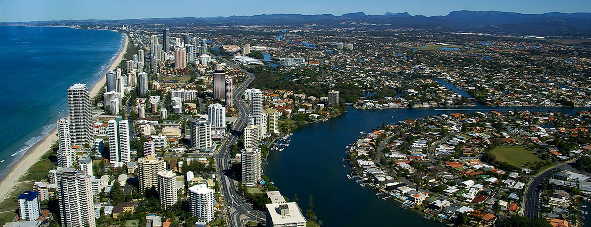
By 2090, sea-levels around Australia are expected to rise between 45 and 82 cm*, depending on greenhouse gas emissions, how quickly land-based ice sheets melt, and regional differences. With millions of people and billions of dollars’ worth of infrastructure in Australia’s coastal regions, rising sea levels pose a significant threat to coastal communities.

Coastal councils are on the frontline of responding to this change, as they ensure that planning and services will accommodate impacts and disruptions that rising sea levels will bring. To carry out this task effectively, council planners and managers need to know how sea-level rise will affect their particular council area.

This detailed information is now available, thanks to research carried out through a project that was jointly funded by the ESCC Hub and the National Climate Change Adaptation Research Facility (NCCARF).

Building on projections that were developed for Climate Change in Australia, our researchers have prepared comprehensive sea-level projections for all Australian coastal councils, including all mainland and Tasmanian councils and the Torres Strait Islands.

Projections have been calculated for 10-year intervals from 2020 to 2100, under four greenhouse gas emissions scenarios. Researchers have also developed corresponding allowances – the height that coastal defences need to be raised in order to provide the same level of protection as they do today.

The projections and allowances are available through CoastAdapt, a new online resource being the developed by NCCARF with funding from the Australian Government. Together with inundation mapping prepared by the CRC for Spatial Information, the sea-level information on CoastAdapt provides local government with a valuable tool in their climate adaptation toolkit.

CoastAdapt is currently in beta release. The final version will be released early in 2017.


More detail about this work is available in the report prepared for NCCARF: Sea-Level Rise and Allowances for Coastal Councils around Australia – Guidance Material.


*This projected sea-level rise is for a high emissions scenario (RCP 8.5) for 2090 – see Chapter 8 of the Climate Change in Australia technical report, available here.

Sea-level information for local government was last modified: October 27th, 2016 by Karen Pearce

Latest blog posts

  • Clouds over the Southern Ocean

    Something in the air: how determining the composition of the Southern Ocean atmosphere will give us better climate projections

    5 February, 2018
  • Bushfire with pyroconvective clouds

    Conditions more conducive for pyroconvection

    2 February, 2018
  • Frost on grass blades

    Not just heat: even our spring frosts can bear the fingerprint of climate change

    14 December, 2017
  • Aerial view of mangrove dieback in the Gulf of Carpentaria

    Climate drivers of the 2015 Gulf of Carpentaria mangrove dieback

    27 November, 2017
  • Four smokestacks billowing smoke against a blue sky

    Fossil fuel emissions hit record high after unexpected growth: Global Carbon Budget 2017

    14 November, 2017
The Earth Systems and Climate Change Hub is funded by the Australian Government’s National Environmental Science Program, with co-investment from the following partner agencies.


CSIRO logoBureau of Meteorology logoAustralian National University logoUniversity of Tasmania logoUniversity of New South Wales logoMonash University logo.The University of Melbourne logo
  • Facebook
  • Twitter
  • Linkedin
  • Email

© 2017 Earth Systems and Climate Change Hub | Legal notice | Staff SharePoint login


Back To Top