692
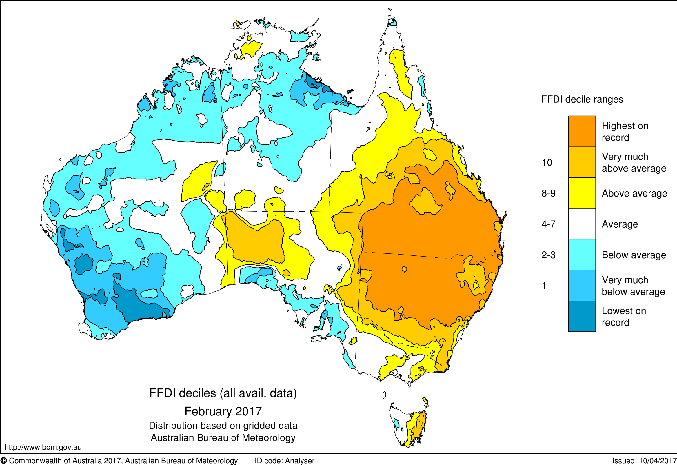
This map shows that the FFDI values in February 2017 were above average for most of eastern Australia, with large regions experiencing the highest FFDI values on record.
This map shows that the FFDI values in February 2017 were above average for most of eastern Australia, with large regions experiencing the highest FFDI values on record.