 Climate change in Australia
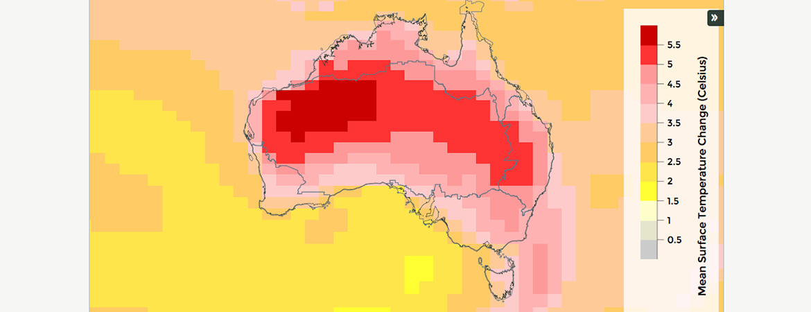
This website provides the most comprehensive climate projections for Australia to date, with a range of options for exploring and downloading data.
 Sea level, waves and coastal extremes
This website provides information about sea level (and what causes changes), waves, coastal extremes, and ocean energy, as well as information about the people who work on the team and their publications. The website includes data download for sea level data, and information about our citizen science project to digitise tide gauge data.
 Tropical cyclone projections portal
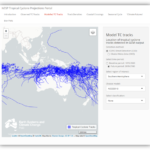
This portal provides interactive features which allow users to generate maps, plots and statistics which summarise tropical cyclone activity, focused on the frequency and spatial distribution of tropical cyclones in the future for our region. Features include observed tropical cyclone tracks, modelled cyclone tracks, track density maps, coastal crossings and seasonal cycle and annual frequency box plots.
Visit website | Metadata statement
 ACCESS-OM2 Model Output Collection
ACCESS-OM2 is the ocean-sea ice component of Australia’s climate model. ACCESS-OM2 outputs are stored as part of the larger COSIMA collection of model output and are available from NCI.
 ACCESS Diagnostic Toolkit version 1
The ACCESS diagnostic tool kit (version 1) is a collection of computer programs written and used for investigating the key systematic errors in a high resolution (60 km grid) version of the current ACCESS atmospheric model (with the GA7 climate configuration). The computer programs and some netCDF files containing the intermediate results of the computation are made available to NCI users through a NCI code repository.
Read more about the diagnostic tool kit | View related technical report | Metadata statement
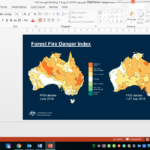 Fire weather climatology maps and data products
These fire weather climatology maps and data products are based on daily values of the Forest Fire Danger Index (FFDI) from 1950 to 2016. The FFDI data are calculated from temperature, rainfall, wind speed and humidity, based on a gridded analysis of observations throughout Australia. The FFDI datasets are designed to be used for climatological applications such as in relation to broad-scale temporal and spatial variations in Australian fire weather conditions.
View dataset | Read publication on the FFDI dataset | Metadata statement
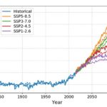 ACCESS Coupled Model Intercomparison Project Phase 6 (CMIP6) data sets
The ESCC Hub supported two Australian model submissions, ACCESS-CM2 and ACCESS-ESM1.5, to the internationally-coordinated Coupled Model Intercomparison Project Phase 6 (CMIP6). The entry-level (DECK and historical) simulations required for CMIP6 include a pre-industrial simulation (piControl), constrained CO² (known as amip experiment), 1 percent CO² increase per year (1pct CO²) and 4 times CO² concentrations relative to preindustrial conditions (abrupt4x CO²). Both models are participating in a number of additional model intercomparison project (MIPs).
The data sets from the DECK and historical simulations are available on the Earth System Grid:
- CSIRO-ARCCSS ACCESS-CM2 model output prepared for CMIP6 CMIP
- CSIRO-ARCCSS ACCESS-CM2 model output prepared for CMIP6 ScenarioMIP
- CSIRO ACCESS-ESM1.5 model output prepared for CMIP6 CMIP
- CSIRO ACCESS-ESM1.5 model output prepared for CMIP6 ScenarioMIP
- CSIRO ACCESS-ESM1.5 model output prepared for CMIP6 DAMIP
Asymmetry and Diversity in the pattern, amplitude and duration of El Niño and La Niña
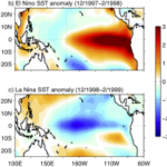 The ESCC Hub collaborated on underpinning research into the variability of the El Nino-Southern Oscillation (ENSO) and Indian Ocean Dipole. This guide explains why we should regard ENSO as asymmetric. This knowledge is important as the ENSO pattern is becoming more frequent and intense under climate change. Extreme events (floods, bushfire, drought) associated with either phase have repercussions for long-term planning and resource management. This research also highlights the need for further research and development into climate models, which are biased towards ENSO symmetry.
ESCC Hub metadata catalogue
Over the six years of the Hub we’ve produced a range of datasets, tools and software. You can find the metadata for these data outputs in the relevant project level metadata statement below:
- Project 2.1 & 5.1 & 2.5 – ACCESS model development and CMIP6 simulations
- Project 2.2 & 5.2 – Climate variability and change
- Project 2.3 – Decadal prediction and marine heatwaves
- Project 2.4 & 5.7 – Ocean change and heat uptake
- Project 2.6 & 5.3 – Developing improved climate change projections for Australia
- Project 2.7 & 5.4 – Hydroclimate and water resources
- Project 2.8 & 5.5 – Extreme weather and hazards
- Project 2.9 & 5.6 – Carbon budgets
- Project 2.10 & 5.8 – Changes in marine and coastal climate
- Project 2.11 & 5.9 – Natural habitats for coastal protection and carbon sequestration
